
Maps
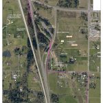
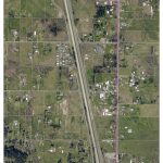
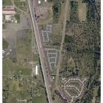
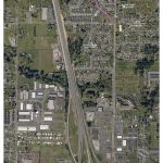
The detailed maps show the location of the new pipeline relative to roads and adjacent properties. The maps provide an aerial view and identify easement boundaries, edges of pavement, property lines, and nearby wetlands.
-
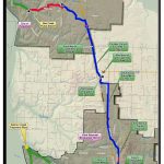
DCWTS Project Map
-
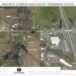
Ridgefield Pipeline and Pioneer Canyon Pump Station (N 45th Ave to S 6th Way)
-
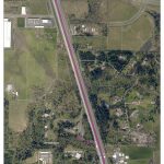
I-5 Median Pipeline (S 6th Way to Carty Road)
-
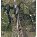
I-5 Median Pipeline (Carty Road to SR 502, including Southbound Rest Area)
-
Northbound Rest Area Pipeline and Pump Station/209th Street Pipeline and Pump Station (Northbound Rest Area to NE 10th Ave south of NE 209th St)
-
10th Ave Pipeline (NE 199th to NE 179th St)
-
Union Road Pipeline (NE 179th St to NE 159th St)
-
20th Ave Pipeline and Legacy Pump Station (NE Union Road to NE 20th Ave / NE 159th St to NE 139th St)